


Departing Government House in the direction of Boundary Road, turn right at the corner and ascend to follow MacGregor Terrace. In so doing, you will be following the old Stafford- Bardon tram route as it swung around from Latrobe Terrace to climb through the Bardon shopping centre to its highest point at the top of MacGregor Terrace. This route provided an alternative for returning from the city to my parents’ home at Ashgrove in the 1960s. It was an interesting trip although necessarily sedate and deliberate due to the steepness of the serpentine track and the narrowness of the roads. As you follow the ridge further on Simpsons Road, you note the steep descents on both sides allowing some fine views between the dwellings on either side which initially are a mixture of blocks of flats and houses, the latter mainly timber, but later the detached houses typical of old Brisbane suburbia.
While you will continue on Simpsons Road for several kilometres, the tram route diverged from it at the top of Chiswick Road which it descended to obviate the need for two more sharp bends and to take a more direct route to its terminus. After descending to Bowman Park on Simpsons Road where it turns left, you once again meet the old tram route as it runs its course towards the terminus which was located just around the corner of Morgan Terrace to the left where its site is still marked by the presence of a few shops.
However, you go straight ahead through a cutting and pass Bardon Anglican Church, formerly known as St Mary’s, on the left.
The road now crosses Ithaca Creek and climbs past Bardon State School on the left. The latter was a relative latecomer to the education scene of inner Brisbane having opened in 1948 just in time for the Baby Boom. Continue along the road over the crest of the hill, apparently known as Bardon Treetops, until you reach Carwoola Street where you turn left, crossing the bridge, and taking the shady path along Ithaca Creek.
The vegetation along the creek banks has been restored and features many native trees and shrubs including some rainforest species providing a thick overhead canopy lending deep shade, particularly welcome in hot summer months. You will soon reach the open fields of Purtell Park, the home of the Western Suburbs (Panthers) Rugby League Club and a favourite haunt of flocks of sulphur-crested cockatoos in the late afternoon. Leaving the park, take Lorward Avenue and then Morgan Terrace to return to the former tram terminus. Turn left to traverse the cutting once more but this time turn right onto Bardon Esplanade where you can again enjoy the shady bank of the creek. The road bows around to the right where it meets a walking track coming from a footbridge across the creek. Beside the path is a storyboard giving some history of the area. Keep the creek on your left and proceed into Bowman Park, the home of the West Brisbane Cricket Club and the Bardon Latrobe Football Club.
After following the path on the northern side of the park, take the first exit path through the dense foliage and cross Bowman Parade. Turn towards the Bardon Bowls Club and once you have crossed the bridge, take the path on your right to continue along the shady course of Ithaca Creek until you reach a footbridge which you cross to ascend to Cecil Road, following it to the left before turning right into Northam Avenue to commence a steady ascent towards Jubilee Terrace. Here you come to the high point of the old tram route passed previously, whence you retrace your steps to Fernberg.
1 In the 1960s, services at St Mary’s were attended on occasion by Sir Henry and Lady May Abel-Smith.
Scenic Spots
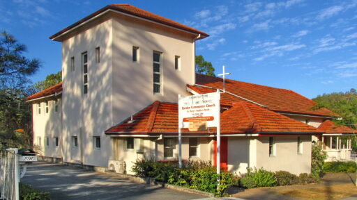
St Mary’s Bardon Anglican Church

Credit: Creative Commons image used with no modification.
St Mary’s Bardon Anglican Church
Discover St Mary’s Bardon Anglican Church, a charming place of worship built in 1937, known for its distinctive timber architecture and serene setting amid leafy surroundings.

Bardon Treetops Views

Bardon Treetops Views
From this elevated spot, walkers are rewarded with sweeping views over Brisbane’s leafy suburbs. It’s a peaceful retreat from the surrounding urban landscape.
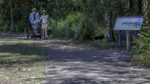
Bowman Park’s History and Recreation

Bowman Park’s History and Recreation
Storyboards detailing local history complement the park’s recreational spaces, including an oval and walking trails.