On this walk you will pass by one of the original houses in the district, visit the graves of Queensland’s second and sixth governors, and in the process walk along some charming suburban streets in Rainworth, Toowong, Auchenflower and Rosalie. You set off to follow Fernberg Road to the east over the crest with the Government House grounds on your right and continue down the slope to Murruba Street which you follow with the remnant native bush of the grounds above you.
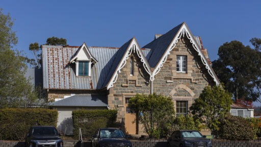
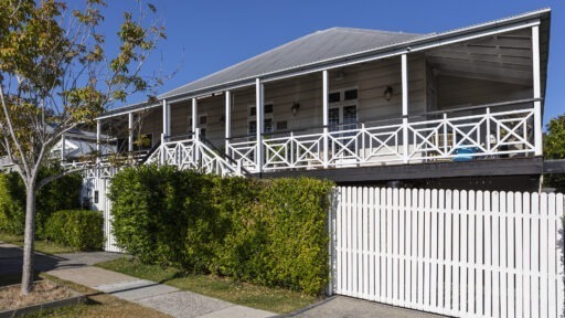
Having reached Rainworth Road passing the low-lying Government House “horse paddock” on your right, you can look across at Number 4 where stood my grandparents’ workers’ cottage, mentioned in the Introduction, of which my grandfather was inordinately proud. Today, still looking back across to the horse paddock, it stands encased within eccentric, some might say unsympathetic, modifications and extensions, although, of course, I could not comment. For some idea of how it looked when we visited in the 1950s, look at the restored cottage two doors along.
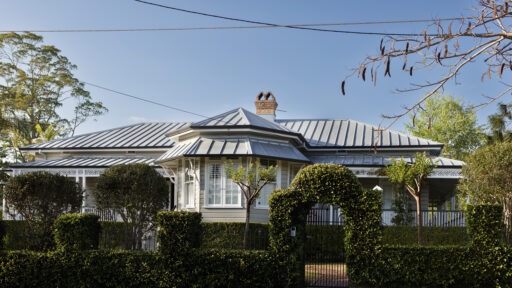
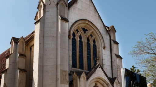
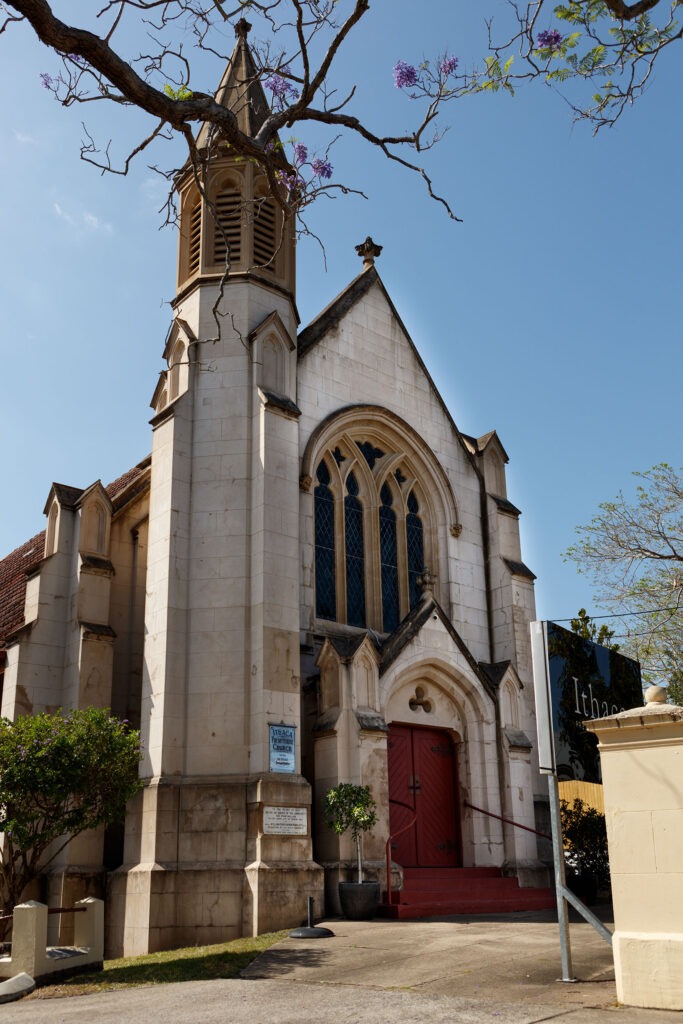
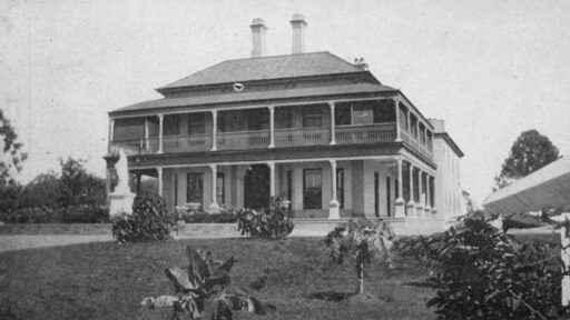
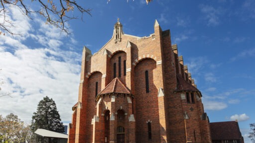
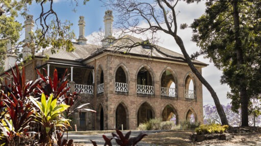
Crossing Baroona Road you will see Norman Buchan Park as you continue along Rainworth Road until you reach Barton Street which you now ascend. Climbing the hill you pass historic Rainworth House, built as a farmhouse in 1862 by then Surveyor General Sir Augustus Gregory and listed on the Queensland Heritage Register. The original extensive grounds have been long since subdivided and the outbuildings seen in 19th century photographs no longer exist. However, the beautifully restored house continues to lend its colonial charm, as well as its name, to the surrounding district.
As you continue, you will see a variety of domestic architectural styles from late colonial to modern vernacular. The road bends to the right and eventually takes you to a T-junction from whence you walk up Fairseat Street to its intersection with Birdwood Terrace. Here, cross the road and turn right continuing until it intersects with Route 5 (Frederick Street) where you turn left and descend until you reach the safety island, the best place for you to cross carefully between the waves of heavy traffic.
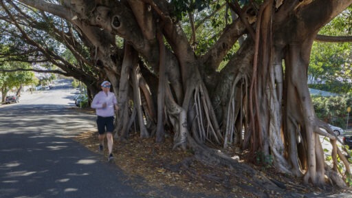
Enter Toowong Cemetery, Queensland’s largest, where you see many mature trees scattered between the grave sites, headstones, and memorials in a park-like landscape, including numerous towering specimens of our majestic native conifers: the Bunya Pine, the Hoop Pine, and the Kauri Pine.
Go south following the internal road that runs close to the boundary parallel to Route 5. When you have reached First Avenue, turn right and continue until you reach Garland Avenue, named for Canon David Garland, the major architect of Australia’s Anzac Day commemorations; he and his wife are buried about halfway along on the right.
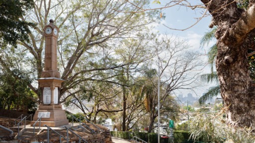
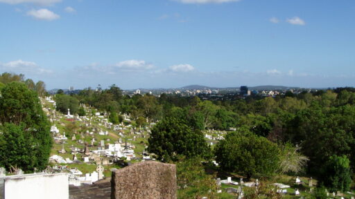
At the end of the avenue, you reach the next intersection where, to the right, you will see a steep hill before you, topped with two large monuments. Ascending the knoll by the grassy passage between burials you reach the larger of the two, the imposing memorial for Samuel Wensley Blackall, Queensland’s second governor, who died in office in 1871 and was the first person entombed in this cemetery.
North-east of this monument lies the less impressive but also well-maintained grave of Sir Anthony Musgrave, sixth governor, who like Blackall died in office, being the only other Queensland governor to do so. They were the only colonial governors to be interred in the state. A little further west is found the tombstone of Sir Samuel Griffith, variously Premier (twice), Lieutenant-Governor and Chief Justice of Queensland, co-author of the Australian Constitution, and first Chief Justice of the High Court of Australia. Many other notable Queenslanders were also buried here including Steel Rudd (Arthur Hoey Davis). There is much scope for further exploration here but now we must press on and leave that for some other day.
Descending the hill by one of the grassy paths, retrace the route to the safety island on Route 5, recross and ascend once more to Birdwood Terrace, and follow it eastward. On a clear day, you will see Mount Barney and the Border Ranges in the far distance to the south. As you proceed further you will also be afforded good views over the leafy suburban landscape of Toowong, Taringa, and St Lucia. On your right, you may also note a good example of a Federation-style house complete with terracotta-tiled roof and finials.
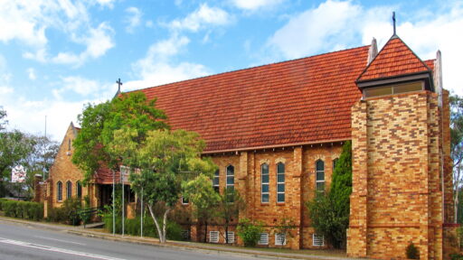
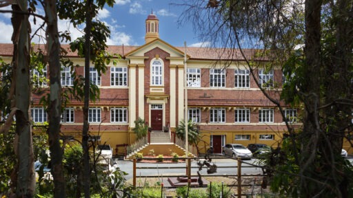
Rounding a dogleg bend you find yourself in Haig Road, continuing the eponymous theme of First World War commanders. Further along, you will be tempted by several potential refreshment stops but if you are able to resist them, you will soon come to a roundabout where you turn into Bayswater Street passing Milton State School opposite. The school was established in 1889 and boasts heritage-listed main buildings built in the 1920s and 1930s by the State Works Department in a style similar to many others of that era but with unique distinguishing features such as the projecting gabled entrance to the main brick building in painted rendered brick with a Juliet balcony above the door. The school abuts Gregory Park (formerly Red Jacket Swamp, giving a hint of its flood-prone nature) which provides a large playground.
At the end of Bayswater Street, you reach Baroona Road where you should cross using the nearby pedestrian crossing that you see to your right and, having done so, turn left. You now enter the Rosalie Village shopping precinct which offers a varied range of goods and services to the local community and more temptation for you to resist. At the next corner turn right into Nash Street and continue to the roundabout where you will need to cross to turn left into Beck Street. Here you will pass many traditional Queensland workers’ cottages as you make your way to the T-intersection to rejoin Murruba Street, where you will retrace your steps towards Fernberg Road and doubtless enjoy the invigorating climb back up to Government House where you should feel free to reward yourself with a sense of accomplishment and a well-earned breather.
Scenic Spots
Rainworth House


Rainworth House
Built in 1862 by Sir Augustus Gregory, this heritage-listed colonial farmhouse is an enduring part of the district’s history. Its beautifully preserved architecture and association with Queensland’s early settlement make it a standout landmark.
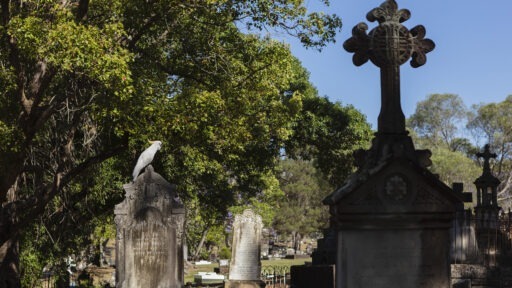
Mature Native Trees in Toowong Cemetery


Mature Native Trees in Toowong Cemetery
Towering Bunya, Hoop, and Kauri Pines create a tranquil, shaded environment among the graves. These iconic trees add a natural grandeur to the cemetery’s park-like landscape.
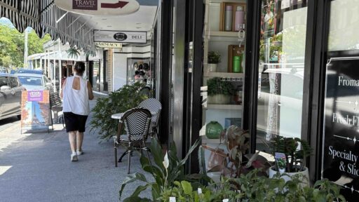
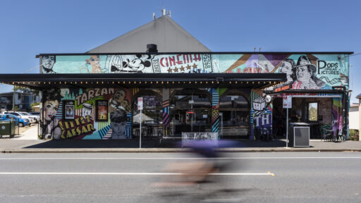
Rosalie Village

Rosalie Village
Stroll through the vibrant precinct of Rosalie Village, offering a blend of history, architecture, and local culture.